
A city open data portal is a public website where a municipal government publishes its records in machine-readable form, so anyone can search, download, map and reuse them through a browser or an API. Understanding how city open data portals work matters because the portal is not a website with a few files on it. It is a pipeline, and most of the friction developers hit comes from how that pipeline was built.
The short version: departments collect data in whatever systems they already run, a data steward turns those extracts into a documented schema, the city’s chosen platform catalogs it with metadata, privacy review removes anything sensitive, and the dataset goes live on a refresh cycle. Everything else on the portal hangs off those steps.
Table of Contents
- What Is a City Open Data Portal?
- Why Cities Publish Open Data
- How City Open Data Portals Work Step by Step
- Step 1: Cities Collect Data From Departments and Systems
- Step 2: Data Is Cleaned, Standardized, and Checked
- Step 3: Datasets Receive Licenses and Access Conditions
- Step 4: Data Is Published in a Catalog or API
- What Information Does a Data Catalog Provide?
- How Developers Access and Use Portal Data
- What Are APIs and Why Do Cities Offer Them?
- How Often Should Open City Data Be Updated?
- How Do Cities Protect Privacy While Sharing Data?
- What Can Go Wrong With an Open Data Portal?
- How to Tell Whether a City Data Portal Is Reliable
- Frequently Asked Questions
- What is an open data portal?
- What is the Socrata Open Data portal?
- What is a data portal used for?
- What is open data and how is it used?
- Do cities have to open data by law?
- How do I find and filter my city’s open data portal?
- What to Do First
What Is a City Open Data Portal?
An open data portal is the central, searchable catalogue where one government body publishes all of its datasets in one place, rather than burying each one in a separate department website. Cities use them for three jobs that never change, no matter which software sits underneath: discover, download, reuse.
Discover means a resident can search by topic and narrow results with filters like department, date or neighbourhood instead of emailing someone for a spreadsheet. Download means the data leaves as CSV, JSON or a spreadsheet rather than a locked PDF. Reuse means a developer can pull the same records programmatically through an API and build something nobody in city hall imagined.
Who operates one? Usually a small team inside the city’s IT, innovation or digital services office, sometimes spread across a department of records and a privacy officer’s desk. Who uses one? Residents, journalists, researchers, students, neighbourhood organisers, private-sector developers, and the city’s own analysts, who frequently become repeat users of data they helped publish.
One warning about terminology: a portal is not the same as Data.gov, which is a federal catalogue that indexes state, local and tribal datasets. A city portal holds the city’s own data and often links out to regional and state systems, so you may see the same dataset listed in more than one place.
Why Cities Publish Open Data
Accountability is the reason most city councils approve it. A budget export that a resident can download turns a debate about a budget line into something checkable. The same logic applies to 311 service requests, where a block-by-block breakdown shows which streets generate the most complaints.
Then there is operational value. Departments discover that the data they publish gets used internally too. A transit agency watching how riders interpret a stop-level feed ends up fixing ambiguous field names. A planning office sees its own permit data through someone else’s analysis and finds gaps in how it records applications.
Research and journalism sit in between. Academic researchers use historical permit and inspection records that would be impossible to gather by hand. Local reporters use the same files to track a pattern that a press release never mentioned. Small businesses use economic development and permitting data to plan where to expand.
Expectations matter too. Federal open data policy pushed agencies toward machine-readable releases by default, and many municipalities followed with their own policies. So “why does my city not have an API for this?” is now a reasonable question rather than an eccentric one.
How City Open Data Portals Work Step by Step
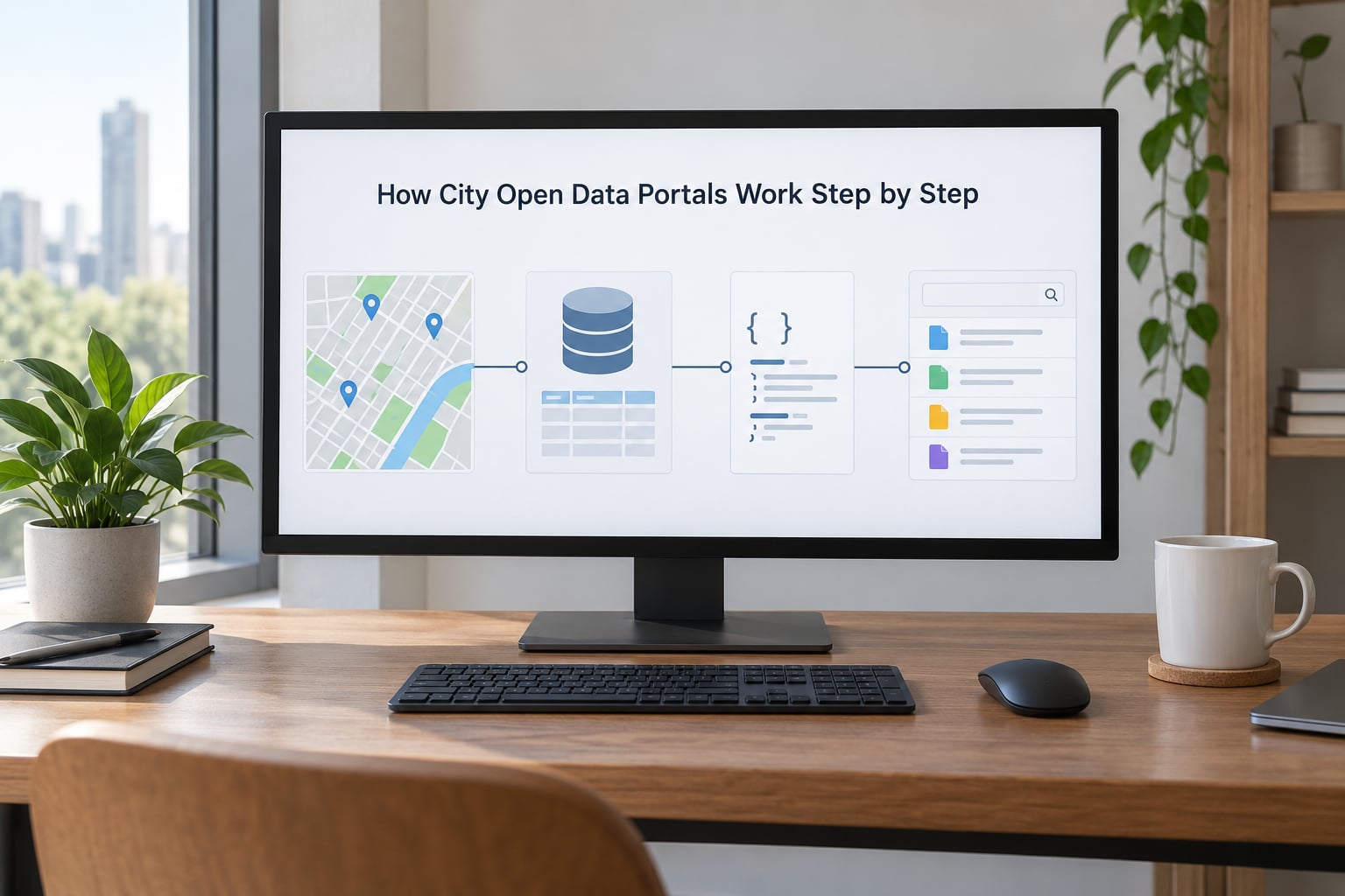
Step 1: Cities Collect Data From Departments and Systems
Municipal data starts inside the system that already runs the service. A permitting system holds building applications. Traffic sensors push counts every few minutes. The finance system holds budgets and payments. Parks, libraries, inspections and emergency dispatch all generate their own records, each in a format its vendor designed.
At this stage nobody is thinking about openness. Each department collected its data to run its own operation, and collecting it well comes with real obligations around privacy and security. A 311 record contains a name, an address and a description of a problem in someone’s home, which is exactly the kind of record that needs a decision before it goes anywhere public.
Step 2: Data Is Cleaned, Standardized, and Checked
Raw extracts get standardised before they ever reach a catalogue. The useful work here is unglamorous: removing duplicate rows, normalising dates into one format, fixing inconsistent spellings of the same street, and mapping department-specific codes onto shared values so two datasets can be joined.
Schema design and the data dictionary come next. A schema decides what fields exist, what type each one is, and what a null means. The dictionary explains each field in plain language with units and allowed values. This is the single most valuable document on any portal, and the one most often missing.
Validation rules then run automatically. A permit record with no address fails. A stop with a latitude outside the city boundary fails. A duplicate row count above a threshold gets held back. Cities that skip this step end up publishing files nobody can trust, which pushes developers back to web scraping.
Step 3: Datasets Receive Licenses and Access Conditions
Every published dataset carries a licence telling people what they may do with it. Most municipal portals use an open licence close to Creative Commons Zero or the Open Data Commons Public Domain Dedication, which waive rights to the extent legally possible and require only attribution. A few datasets carry conditions, usually a disclaimer about accuracy rather than a restriction on reuse.
Some records are public but not open. A dataset might be available for download while a subset of fields sits behind a request form, or a spatial layer might be generalised so block-level detail is blurred. Public and unrestricted are different bars, and a good portal labels which one you are looking at.
Step 4: Data Is Published in a Catalog or API
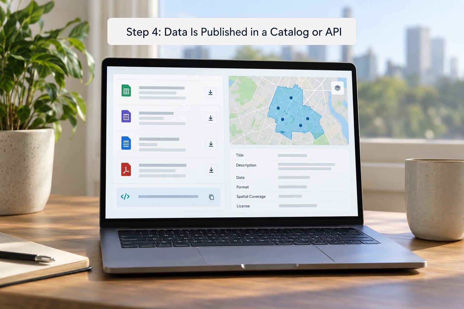
The portal itself is software, and cities pick between three common platforms and a custom build. The platform choice changes the URL patterns, the API dialect and how metadata is modelled, but not the underlying workflow.
| Platform | How it is hosted | Access model | Strong fit for |
|---|---|---|---|
| Socrata | Vendor-hosted cloud, city account | Public site plus SODA/SoQL API and an app builder | Cities wanting a full site quickly, especially 311 and inspection data |
| CKAN | Self-hosted, often on city or county infrastructure | Public catalogue plus a REST API with a datastore plugin | Regional consortia and cities that want control of their own stack |
| ArcGIS Hub | Vendor-hosted or enterprise licence | Feature services, map layers, REST endpoints | Portals led by planning, GIS or economic development teams |
| Custom build | City infrastructure | Whatever the team builds, usually with an API layer | Cities with a dedicated data team and a design they cannot compromise on |
Once a dataset is ingested, it becomes reachable in four ways, and a serious portal offers all four.
Downloadable files suit one-off analysis. Catalogs suit browsing and filtering by metadata. Dashboards and embedded maps suit residents who want an answer without writing code. APIs suit anything that has to stay current.
| Format | What it is good for | Watch out for |
|---|---|---|
| CSV | Spreadsheet analysis, quick joins, most one-off downloads | Flattens nested data; encoding surprises in older exports |
| JSON | Application code, nested records, API responses | Heavier to eyeball; array wrapping differs between platforms |
| XLSX | People who want formatting and multiple sheets | Large files slow down; formulas can hide stale values |
| GeoJSON | Point, line and polygon layers for web maps | Large boundaries get heavy fast, so files are often simplified |
| Shapefile or geodatabase | Desktop GIS analysis in QGIS or ArcGIS Pro | Multiple files, older format; many columns get truncated |
Two smaller choices matter more than people expect. Bulk downloads usually mean a zip of every row, which nobody wants when they need last month’s requests for one neighbourhood. A working API with filtering saves the trip. And a visible download count, which Sunlight’s open data guidelines recommend, tells a department whether anyone bothered.
What Information Does a Data Catalog Provide?
A catalog entry is more than a download link. The metadata is what lets you decide whether the dataset fits your question before you spend an hour cleaning it.
Look for a description of what the records represent and, critically, what they do not. Owner department, so you know who can answer questions. Update frequency and the date of the last refresh, so you know if the file is stale. Field definitions with units and allowed values. Row counts and geographic or temporal coverage. The source system and how the data is collected. The licence, and a contact for corrections.
If a catalogue entry gives you a title, a file size and nothing else, you are guessing. Treat missing field definitions as a signal that the publisher has not done the work yet, and cross-check the numbers against a second source before you build on them.
How Developers Access and Use Portal Data
Finding the portal is the first hurdle, and it is a real one. People regularly post to local forums asking whether anyone uses their city’s portal at all, or which URL it sits behind. Search for the city name plus open data, then check the city’s IT or innovation department site. Once you are in, use the catalogue’s search rather than guessing file paths.
Filter before you download. Most portals let you narrow by date range, category and geography in the browser, and the API repeats those filters as query parameters. Pull only what you need; a filtered extract of 311 requests for a single month is far easier to work with than a multi-year file with hundreds of thousands of rows.
A concrete example: suppose you are mapping how often buses serve each stop. Take the transit stops dataset and note the stop ID, the routes served and the coordinates. Pull the trip or schedule feed for the same period, group by stop ID, and count arrivals per stop across a full weekday. Join that count onto the stops layer by ID, then look at the correlation with the stops that have the longest average wait reported in the 311 complaints feed. Two unrelated-looking datasets, one shared key, a real answer.
Then handle refresh deliberately. Record the retrieval timestamp with your data, store the query parameters rather than the file itself, and re-run on a schedule that matches the update frequency the catalogue claims. If the feed is weekly, weekly is fine. Chasing a dataset that updates daily and grabbing it hourly mostly teaches you to handle 404s.
# Socrata-style API: recent 311 requests, one borough, limited fields
https://data.example.gov/resource/abcd-1234.json?$select=created_date,complaint_type,latitude,longitude&$where=borough=Brooklyn&$limit=500

# CKAN-style API: list published datasets and their formats
https://data.example.gov/api/3/action/package_list
https://data.example.gov/api/3/action/package_show?id=transit-stops
Joining across datasets is where most projects slow down, because departments name fields differently. The parking violations feed may use “violation_time” while the 311 feed uses “created_date”. Budget for a mapping layer between them rather than assuming a shared schema, and check whether the ID formats match too.
What Are APIs and Why Do Cities Offer Them?
A city data API is a documented set of endpoints that returns records as structured data, usually JSON, on request. Instead of downloading a file that goes stale the moment you save it, your application asks the portal for exactly the rows it needs.
Each endpoint has parameters for filtering, sorting, selecting fields and limiting results, and it returns records in a predictable structure. Most portals document rate limits, so that one resident’s script cannot hammer a system sized for a city’s internal use. Larger cities use application tokens or API keys so they can track usage and enforce limits per caller.
Versioning matters more than it sounds. If a city changes a field name or a response format, apps that depend on the old shape break silently. Portals that version their endpoints let old clients keep running; portals that do not leave developers guessing which of the last four Tuesdays changed the rules.
The practical test is simple: if you can build a live map, a dashboard that updates itself, or an automated weekly digest from an API, the portal is doing its job. If you can only download a file, it is behaving like an FTP server with better styling.
How Often Should Open City Data Be Updated?
There is no single right answer, because the right cadence depends on how fast the underlying thing changes and how much it costs to validate a release. Traffic counts and transit arrivals can justify near-real-time updates. Permits and inspections suit weekly or monthly. Adopted budgets and census-derived figures are annual, and publishing them monthly would be theatre.
Three things pull the frequency up. Operational value, where staff use the same feed. External value, where developers have built something that depends on freshness. And cost of validation, since every release is a chance to publish a bad file. Cities that push real-time feeds without automated validation usually end up with a fast, wrong portal.
Whatever the cadence, the catalogue should state it and show the last refresh date. A dataset with no date is not fresh, it is just undocumented.
How Do Cities Protect Privacy While Sharing Data?
The governing principle is that open data should never expose personal information, and cities treat the review step as a gate rather than a formality.
Aggregation combines small counts into larger ones so no individual record can be inferred. Suppression goes further and withholds a cell entirely when the count is too small to publish safely. De-identification removes or masks direct identifiers such as names, phone numbers and full addresses. Geospatial data needs its own care: a precise point tied to a single complaint can identify a household, so many portals offset points or round them to a block or neighbourhood.
Access controls cover the cases where a dataset is genuinely sensitive, such as personnel or investigative material, where the portal publishes a description and a request form instead of the rows. Security review happens earlier too, since not everything in a city’s systems should ever leave them.
Statutory exemptions matter as well. Public records law in most US states allows withholding for personal privacy and law enforcement reasons, so an open data policy usually names those categories explicitly and says who approves an exception.
What Can Go Wrong With an Open Data Portal?
Most complaints about city data come down to the same handful of failures, and each has a fix the city can make.
Stale records with no visible date. The fix is a published refresh frequency, an automatic last-updated stamp and an owner who gets told when a feed breaks. Undocumented fields, where a column called “status” has eight possible values listed nowhere. The fix is a data dictionary maintained with the schema.
Inconsistent formats between departments, which makes joins painful. The fix is a shared convention for dates, coordinates, identifiers and category codes, agreed once and enforced by the ingestion pipeline. Broken endpoints, where a URL documented two years ago returns nothing. The fix is health checks on every API route plus versioned paths.
Unclear ownership leaves nobody to ask when a dataset is wrong. The fix is naming a department and a contact on every entry. Licensing errors cause unnecessary hesitation, since developers assume the worst when reuse terms are missing. And duplicate datasets across the city, county and state catalogues waste everyone’s time; linking to the canonical copy beats republishing it.
How to Tell Whether a City Data Portal Is Reliable
Run this checklist before you build anything on top of a city’s data. It takes about five minutes per dataset.
Check whether the entry has an owner department and a contact. Look for a stated update frequency and a last-refreshed date, then compare it with what you actually get from the API. Read the field definitions and units before assuming what a column means. Confirm the licence allows the use you have in mind.
Test one documented API endpoint and see whether it returns data that matches the preview. Look for a changelog or release notes on the main datasets you depend on. Then check whether the portal is indexable by search engines, which is a small signal that the city treats publication as a real programme, and check whether the city’s open data policy names an office responsible for it.
If a portal passes those checks, you can build on it. If it fails on dates and metadata, plan for manual refreshes and keep copies of everything you pull.
Frequently Asked Questions
What is an open data portal?
An open data portal is a public website where a government body publishes machine-readable datasets in one searchable place, instead of scattering them across department websites. Residents can filter and download files as CSV or JSON, and developers can pull the same records through an API. Cities use portals for 311 requests, permits, budgets, inspections and transit data.
What is the Socrata Open Data portal?
Socrata is the vendor platform behind a large share of US city portals, including many 311 systems. It gives a city a hosted public site, a metadata catalogue, built-in charts and maps, an application builder for internal dashboards, and the SODA API, which returns filtered records as JSON or CSV. Its SoQL query dialect means you can sort, group and aggregate in the request itself.
What is a data portal used for?
A data portal is used for four things: letting people find datasets without emailing a department, letting them download those datasets in a format they can analyse, letting developers query the same records programmatically, and letting a department publish once and reuse the data internally. It also gives the public a record of what government does, which matters when budgets and service records are published as data rather than as PDF tables.
What is open data and how is it used?
Open data is information released in a machine-readable format under a licence that lets anyone use, modify and redistribute it, without asking permission first. In practice a city uses it for transparency work, journalism, academic research, civic app development and economic development analysis. Journalists investigate permit and inspection patterns, researchers study long-run trends, and developers build tools residents would otherwise have to request.
Do cities have to open data by law?
It depends on where you are and which records you mean. Many states have public records laws that make data a public resource, but those laws usually allow exemptions for privacy, law enforcement and pending litigation, and they do not require a portal or an API. Federal open data policy pushes agencies toward machine-readable releases by default, and several US municipalities have adopted their own open data policies that go further than statute.
How do I find and filter my city’s open data portal?
Search your city name plus open data, or check the IT, digital services or innovation department section of the city website. Once inside, use the catalogue search and filter by department, dataset type and date range. For bulk pulls, use the API rather than downloading everything, and filter on the jurisdiction or city field when a dataset mixes city, county and state records.
What to Do First
Start with one dataset you actually care about rather than browsing the catalogue. Check its last-refreshed date and field definitions, pull a filtered slice through the API, and save the query alongside the data so you can reproduce it later. If the metadata is thin, that tells you something useful about how much automation is behind the portal, and it tells you how often you will need to check by hand.