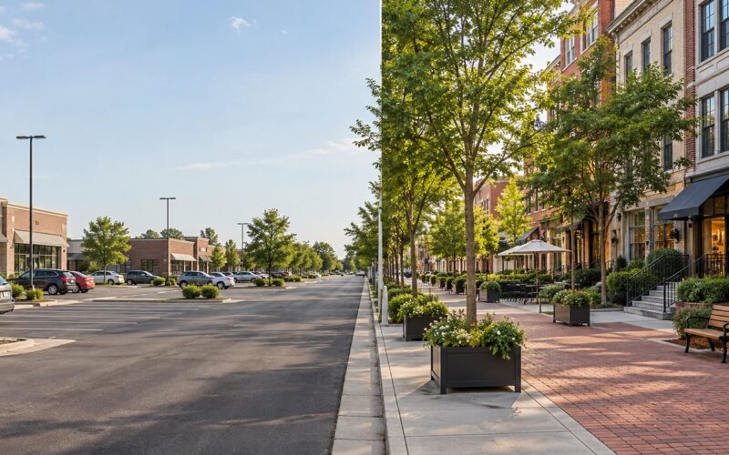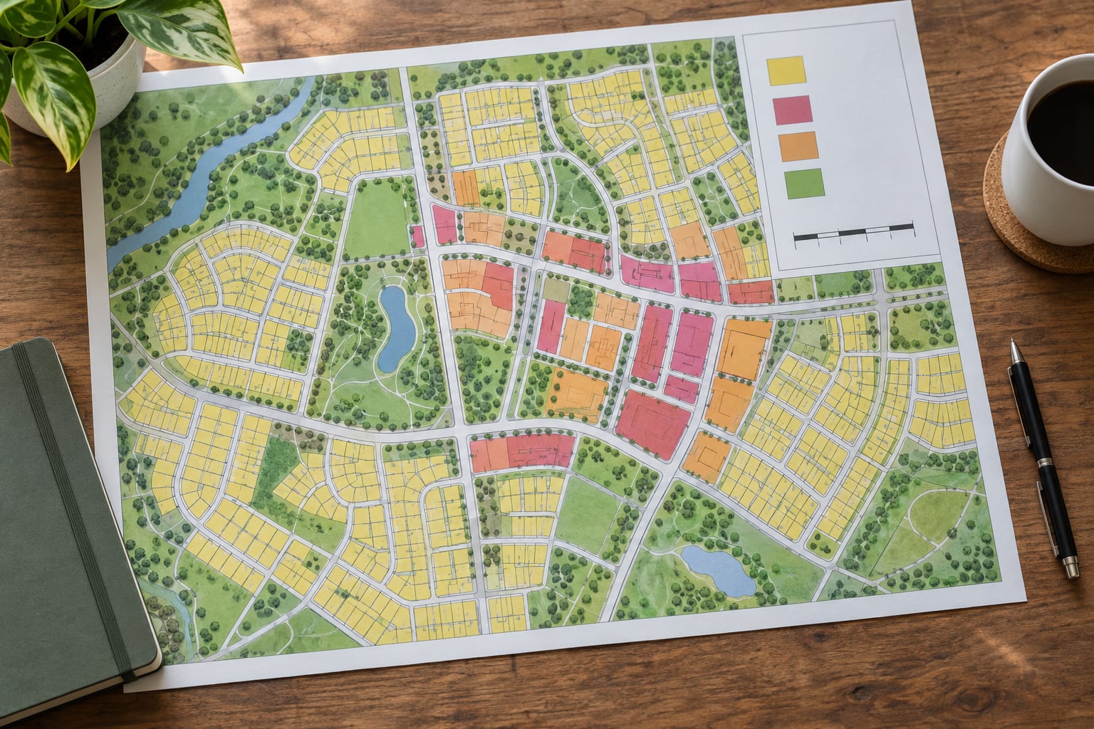
A zoning code shapes a neighborhood by deciding, parcel by parcel, what may be built there: which uses are allowed, how tall a building can go, how many homes fit on a lot, and how much of the site has to stay open. Those rules set how much housing a city can absorb, where shops and services cluster, and how a neighborhood’s streets, sidewalks and traffic behave for the next decade.
Most people meet their own zoning rules only after something goes wrong. A porch gets flagged, a duplex lands two lots over, a corner lot stays empty for years because nothing profitable fits on it. Knowing how the code works turns those surprises into decisions you can plan around.
Table of Contents
- How Zoning Codes Shape Neighborhoods
- How zoning codes affect everyday neighborhood decisions
- What Is a Zoning Code?
- What Do the Main Zoning Categories Allow?
- How Do Zoning Rules Affect Housing and Density?
- How Do Zoning Codes Shape Streets and Transportation?
- How Do Businesses and Public Spaces Change a Neighborhood?
- Why Do Cities Change Their Zoning Codes?
- What Can Residents, Developers, and Civic Teams Do?
- Frequently Asked Questions
- What are the three types of zoning?
- How do zoning ordinances affect property value?
- How do I read a zoning map?
- What is the difference between a zoning code and a building code?
- Which states have banned single-family zoning?
- Are you allowed to run a business from a residential neighborhood?
- Conclusion
How Zoning Codes Shape Neighborhoods
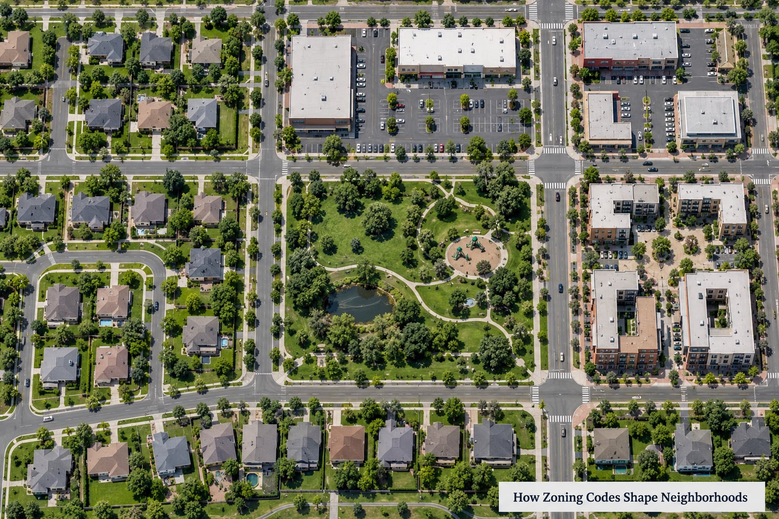
Zoning shapes a neighborhood through five levers: permitted uses, density, building placement, transportation requirements, and public space. Change any one of them and the others follow. Allow apartments over a retail strip and you get more people within walking distance of the bus, which supports the shops, which makes the walk itself safer.
Take an ordinary six-block area. Under one zoning scheme the blocks zoned residential hold detached houses on large lots, the commercial parcel holds a drive-through, and the corner stays a lawn. Rezone the corner for mixed-use and allow two extra stories, and the same six blocks gain apartments, a corner shop that stays open past dark, and a street where more people are outside at the same time.
That is the mechanism behind nearly every argument about zoning reform. The dispute is rarely about buildings in isolation. It is about who lives next to whom, what ends up across the street from a school, and whether a bus stop stays useful or becomes stranded.
How zoning codes affect everyday neighborhood decisions
Zoning categories turn into ordinary choices: whether you can build a backyard cottage, put a home office in a spare room, add a second kitchen, or convert a garage. Each answer lives in the district’s use table, not in the code’s overall philosophy. Many codes allow a home occupation outright and require a conditional use permit once clients come to the property regularly.
The same lookup decides business questions. A corner lot zoned for neighborhood commercial can usually host a small shop with no parking minimum; the identical building on a residential lot often cannot serve walk-in customers at all. That single line in the district table is the reason some streets have continuous storefronts and others are residential quiet from end to end.
What Is a Zoning Code?
A zoning code is the local law that divides a jurisdiction into districts and assigns every parcel to one of them. For a given parcel, the district sets a list of uses you may do by right, uses that need a conditional use permit, and dimensional rules covering height, setbacks, lot size, coverage and unit count.
- Zoning code or zoning ordinance is the book of rules, usually organized into chapters of text plus district tables and maps.
- Zoning map is the companion document that shows which parcels carry which district. The text says what is allowed; the map says where.
- Zoning district is the category itself, such as R-1 for a low-density residential district or C-2 for a general commercial district.
- Permitted use is something allowed without further approval. Conditional use is allowed only after a hearing, because the code finds it potentially compatible but not automatically fine.
- Overlay district layers extra rules on top of the base district, which is how historic preservation, airport height and downtown design rules get applied without rewriting the whole map.
Zoning is not the only code that governs land, and confusing them is the most common source of wrong advice. Building codes regulate safety: structural loads, egress, fire resistance, plumbing and electrical systems. Subdivision rules govern how a parcel is split and what infrastructure comes with it. The comprehensive plan, sometimes called the general plan, sits above all of them as a long-range statement of goals, and the zoning code is the tool that implements it.
They work as a stack. The plan says the city wants more homes near transit. The zoning code writes district rules that permit four stories by right instead of two. The building code then tells you how to build that structure safely. Change one layer and the others need updating too.
What Do the Main Zoning Categories Allow?
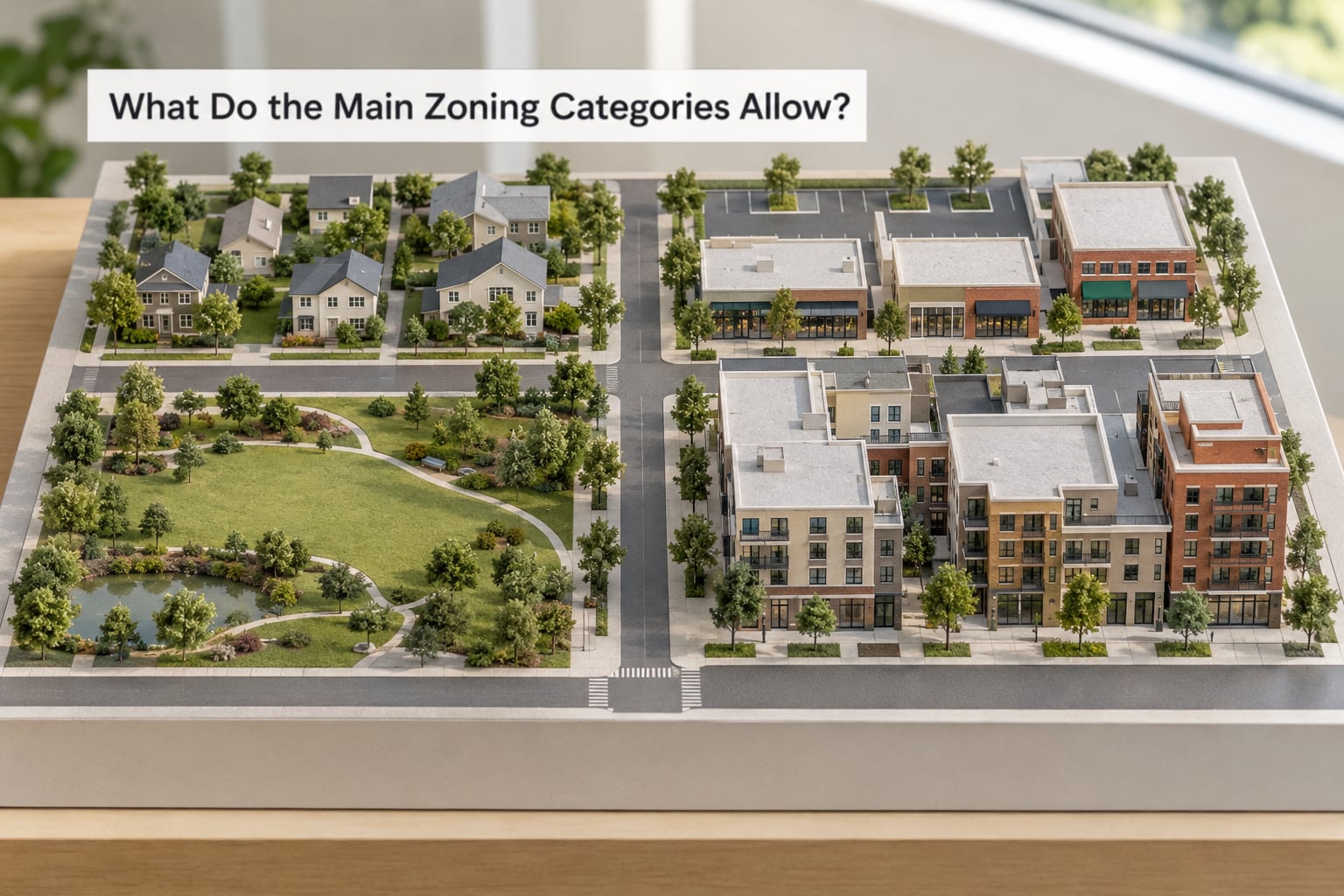
Most codes reduce to a handful of categories. Naming conventions differ between jurisdictions, so R-1 in one county may be written R-7-2 in New York City, but the underlying categories repeat almost everywhere.
- Residential districts run from single-family on large lots through duplex and small multifamily to high-density apartment districts. Density between them is where zoning’s real effect lives.
- Commercial districts cover neighborhood shops, general retail, and central business districts. Parking minimums and frontage requirements often differ sharply between the three.
- Industrial districts permit manufacturing, warehouses and freight, usually buffered from housing by use separation and setback requirements.
- Mixed-use districts allow residences above or beside retail, civic and office uses, usually with reduced parking for the residential share.
- Institutional and civic districts cover schools, government buildings, hospitals and assembly uses.
- Open space and agricultural districts protect parks, floodplains, steep slopes and farmland from building.
| District type | Typical uses | Typical density | Travel effect | Neighborhood result |
|---|---|---|---|---|
| Low-density residential | Detached houses, small accessory units | One dwelling per lot, often minimum lot size 6000 sq ft or more | Car-dependent, sidewalks incomplete | Quiet streets, low storefront vacancy, fewer households per mile |
| Medium-density residential | Duplexes, small multifamily, some accessory dwelling units | 6 to 20 dwellings per acre | More walking and short trips | Mixed incomes in one area, more pressure on parking |
| High-density residential | Apartment buildings, condominium projects | 30 dwellings per acre and up, set by floor area ratio | Transit ridership rises, curb demand rises | More residents near services, larger buildings cast more shade |
| Neighborhood commercial | Corner shops, cafes, professional offices | Low to moderate, often 1 to 3 stories | Short walking trips replace some drives | Storefronts, active corners, tighter parking supply |
| General commercial | Retail, offices, service businesses | Moderate to high | Arterial traffic concentrates on frontage streets | Regional shopping nodes, noise and traffic spillover |
| Industrial | Manufacturing, warehousing, freight | Large floor plates, low headcount per acre | Truck traffic, few pedestrians | Cheap land near highways, limited nearby services |
| Mixed-use | Homes over ground-floor retail, offices, civic uses | Set by floor area ratio, often 3.0 to 8.0 | Trips shorten; walking trips climb | Active street corners, residential above commercial |
Reading that table across a map explains a lot on its own. Neighborhoods where residential density sits low and commercial frontage spreads along one arterial produce long car trips and dormant side streets. Neighborhoods with modest density and commercial permission on most blocks produce the opposite, and residents often experience that difference as neighborhood quality without being able to name the cause.
How Do Zoning Rules Affect Housing and Density?
Zoning affects housing through a small set of dimensional controls, and each one caps supply in its own way. Density is not a single rule. It is the product of how much lot you must have, how much of it you may cover, how tall you may build, and how large each home can be.
| Control | Plain-English meaning | Typical single-family value | Effect on supply |
|---|---|---|---|
| Minimum lot size | Smallest legal footprint for one home | 5,000 to 10,000 sq ft | Sets a hard floor on how many lots exist; the single strongest constraint in many suburbs |
| Lot coverage | Share of the lot a building may occupy | 30% to 40% | Limits footprint independent of height |
| Setback | Distance from each property line | 20 to 30 ft sides, 25 to 30 ft front | Protects light and privacy, consumes buildable land, shapes the street wall |
| Height limit | Maximum stories or feet | 2 stories, 25 to 35 ft | Directly caps density on small lots |
| Floor area ratio | Total floor area divided by lot area | 0.3 to 0.6 | The most direct density dial in mixed-use and downtown districts |
| Units per acre | Dwelling units permitted per acre | 2 to 4 on low-density residential | States an outcome rather than a dimension |
| Parking minimum | Spaces required per unit or per seat | 1 to 2 per unit | Encourages extra parking construction and discourages transit-oriented building |
Compare two districts side by side. The first: 7,500 sq ft minimum lot, 35% coverage, 25 ft front and side setbacks, two stories, floor area ratio 0.5. Working it through, each lot yields roughly one 1,800 sq ft house, about 4,700 sq ft of covered area. The second: 2,400 sq ft lot, 70% coverage, three stories, floor area ratio 4.0, no parking minimum near transit. That lot can carry eight to ten homes in a form that looks like a small apartment building.
The land consumption difference is stark. The first district can hold a neighborhood of houses and a corner store. The second holds a genuine mixed-use block with residents already living above the shops.
That gap is why housing researchers keep finding that binding limits on permissible density translate into higher rents. One widely cited study of California land use regulation estimated each additional regulation adds more than 2 percent to rents and more than 4 percent to home prices. When supply is fixed by rule and demand is not, the adjustment happens in price, and the households squeezed hardest are the ones a supply increase would have served.
Accessory dwelling unit rules work the same way in miniature. A city that permits a cottage in the backyard without a variance can add housing inside the existing lot; a city that requires one treats the extra home as a two-year project, and most owners never apply.
How Do Zoning Codes Shape Streets and Transportation?
Zoning shapes streets indirectly, by deciding what generates the trips and what the street has to hold. A district that allows four dwellings per lot puts more people on a block than a district that allows one per lot, and more people within walking distance of the same bus stop. Land use and transportation are the same system viewed from two ends.
Parking rules are the sharpest lever. Parking minimums require a developer to build a set number of spaces per unit or per thousand square feet of retail. Those spaces have to go somewhere, so the minimum effectively buys land, raises project costs and pushes buildings away from the street edge. Cities that removed minimums and set maximums near transit have seen parking supply fall while development on infill lots rises.
Frontage and access rules follow the same logic. Requiring a curb cut per lot scatters driveway traffic along residential streets and slows through movement. Requiring shared access or limiting curb cuts on a busy corridor concentrates turning movements at a few intersections, where they are easier to manage and easier to signal.
Mixed-use permission matters for curb space specifically. Curb space is a fixed physical resource, and each use wants a slice of it: parking, loading, buses, bikes, trees, outdoor dining. Neighborhoods that convert travel lanes and allow retail with small loading zones tend to reallocate that curb deliberately. Neighborhoods where parking minimums exceed demand end up with a curb that serves parked cars and little else, which is the design most associated with unwalkable streets.
How Do Businesses and Public Spaces Change a Neighborhood?
Commercial permissions decide whether a main street can keep a shop. Storefront design rules, signage limits and required setbacks then decide what that shop looks like, and those requirements are often the difference between a retaillable building and one nobody leases.
Small towns make this practical. A building with a recessed entrance, a blank side wall facing the sidewalk and a sign mounted above the roofline may be perfectly legal under the use rules and still unlettable, because no retailer wants that frontage. A design code that requires doors and windows to face the street and caps sign height can change a block’s leasing rate without touching its zoning designation.
Watch how a main street evolves over time. A residential strip with no commercial permission stays residential, and trips go to the next town. Add ground-floor retail to the same blocks and you get a convenience cluster that shortens daily errands. Add parking minimums on top of that retail, and the strip can lose the small shops first, because an independent grocer cannot absorb twenty required spaces and still make the rent. The use rules opened the door; the parking rule quietly closed one store at a time.
Public spaces follow the same logic. A code that requires street trees, sidewalk width and setbacks creates shaded, continuous sidewalks by default. Where those rules are absent, new construction replaces a shaded frontage with a parking lot and the street reads as hostile on foot even when traffic is light.
Why Do Cities Change Their Zoning Codes?
Cities rewrite zoning for predictable reasons: a housing shortage, a transit investment that needs riders nearby, climate targets, an aging commercial corridor, or pressure to remove rules written under explicitly exclusionary intent.
The oldest pattern here is the history. New York City adopted the nation’s first comprehensive zoning ordinance in 1916, and the U.S. Supreme Court upheld zoning as an exercise of local police power in the 1926 case Village of Euclid v. Ambler Realty Co. In the decades that followed, single-family-only districts spread widely, and in many cities they were applied alongside racial covenants and loan redlining to shape where families of color could live.
Recent reforms come from several directions at once. California enacted SB 9 and SB 10 to allow more housing near transit and job centers, and AB 2011 to speed approvals. Minneapolis reported a roughly 45 percent rise in permits for two- to four-unit buildings between 2020 and 2022 after loosening rules for small multifamily housing. Salt Lake City exempted missing middle housing from some dimensional standards. Auckland’s 2016 Unitary Plan upzoned most of the city, and a later rent study found three-bedroom rents fell by roughly 22 to 35 percent against a modelled counterfactual in which they would have risen sharply.
Reform meets resistance in predictable places. Residents often object to parking, traffic and building height rather than to zoning itself, and state preemption that overrides local choice tends to produce a sharper backlash in towns with strong local identity. Where cities have changed the rules, the visible effect on the ground has often been more small buildings rather than towers, which surprises people who expected dramatic change.
Every change goes through a process: staff analysis, a planning commission hearing, elected officials, and public comment. Public hearings are where residents’ objections land, and comments are recorded in the minutes that become part of the record if the decision is later challenged.
What Can Residents, Developers, and Civic Teams Do?
Start by finding your parcel’s district. Most jurisdictions publish a parcel viewer or zoning map portal, and searching an address usually returns the district code, any overlay districts, and the applicable dimensional standards in one screen. New York City’s ZIMAS is a well-known example; most counties run an equivalent public viewer. Save the screen, because the district code is what every other lookup depends on.
Read the district’s use table before the dimensional standards. It answers the question people actually have, which is what the property may be used for rather than how wide a house can be. Note whether home occupations are permitted outright, whether accessory dwelling units need a variance, and how many off-street parking spaces are required for the use you have in mind.
Ask city staff four specific questions: what is the current district, what overlay districts apply, what would a variance require, and what is the notice and hearing timeline for a change. Written answers are more reliable than verbal ones, and staff will usually point you to the specific code section rather than explaining the code in their own words.
Know the four levers residents have. A variance is a request for relief from a dimensional rule where an ordinary condition exists, such as a narrow or irregular lot. A conditional use permit approves a listed conditional use after a hearing. A rezoning changes the district designation, usually at the initiative of the landowner or the city. A planned unit or master plan lets a developer submit one set of rules for a multi-parcel site instead of parcel-by-parcel review. Comment periods on any of these are the main way ordinary residents affect the outcome.
Developers testing a site should count the buildable footprint before drawing anything: lot area times coverage limit times permitted floors, checked against height and setback constraints. If the result does not meet your pro forma, the answer is usually in the district table rather than in the design.
Civic technologists can go further. Zoning and parcel data are among the most widely published open datasets a city has, and they map cleanly into a layered map: district boundaries, parcel lines, transit stops, and sidewalk or bike network. That stack answers questions no single dataset can, like which districts sit within a ten-minute walk of frequent service, or how much of a district is within half a mile of a grocery store. If your city publishes an open data portal, that data is usually there.
Frequently Asked Questions
What are the three types of zoning?
The three core types are residential, commercial and industrial. Residential districts govern where people live and how densely, commercial districts govern retail and services, and industrial districts govern manufacturing and warehousing. Most modern codes add mixed-use districts, which permit homes above or beside retail, plus institutional and open-space districts. Naming varies by jurisdiction, so a code may label them R, C, M and OS rather than spelling them out.
How do zoning ordinances affect property value?
Zoning affects value mainly by limiting what can be built next door. A house in a district that permits only one dwelling per lot carries that constraint into its resale price, because a buyer cannot add a second home. Districts that allow more density and a wider mix of uses tend to carry higher per-square-foot values and more development pressure. One widely cited study of California land use regulation estimated each added regulation raises rents more than 2 percent and home prices more than 4 percent.
How do I read a zoning map?
Open your city or county parcel viewer, enter the street address, and read the district code shown on the parcel. Then decode the suffix, such as an R-7-2, which typically means a residential district, a density of seven units per lot or per zoning acre depending on the code, and a contextual qualifier. Check for overlay districts such as historic preservation or airport height, then open the dimensional standards page to see height, setbacks, coverage and parking rules.
What is the difference between a zoning code and a building code?
A zoning code decides what land may be used for and how much may be built on it, such as allowed uses, height, setbacks, lot coverage and floor area ratio. A building code governs how a structure must be built for safety, covering structural load, fire resistance, egress, plumbing and electrical systems. Zoning is about land use and neighborhood form; the building code is about whether the building is safe. You often need both approvals before construction starts.
Which states have banned single-family zoning?
Several states and cities have restricted or repealed single-family-only zoning through legislation or administrative action. California limits local authority under SB 9 and SB 10 and speeds approvals under AB 2011. Oregon, Montana, Maine and Virginia have adopted statewide measures affecting local zoning authority, with varying scope. Minneapolis and Salt Lake City changed their own codes to allow small multifamily and missing middle housing. The specifics differ, so check the current law for your state.
Are you allowed to run a business from a residential neighborhood?
Most residential districts allow a home occupation, usually defined as work done in part of the home by the resident with no outside employees and little customer traffic. A code that permits home occupation outright lets you run a consulting or bookkeeping practice from a spare room. Regular customer visits, signage, deliveries or employees generally trigger a conditional use permit or a move to a commercial district. Check the district use table for the home occupation definition.
Conclusion
Zoning codes shape neighborhoods by fixing four things at once: what land may be used for, how densely it may be built, how buildings sit on their lots, and what the street has to accommodate. Change one of those and the neighborhood’s housing supply, traffic, storefronts and public space all shift with it.
Your first step is small and specific. Find your jurisdiction’s parcel viewer, look up one address, and read the district’s use table and dimensional standards. Do that once and the rest of the code stops being abstract.