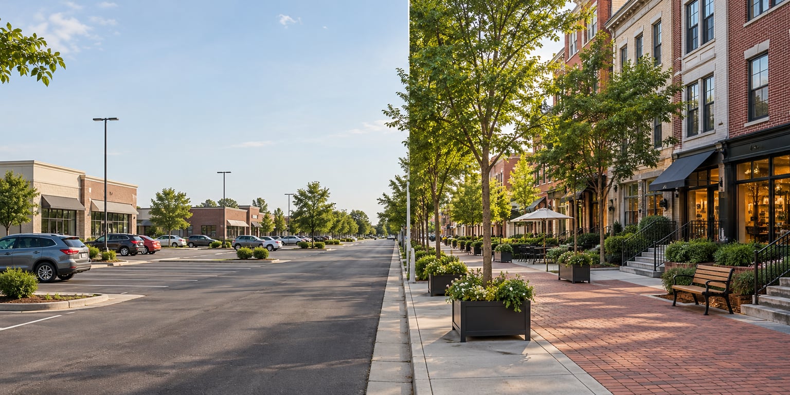
A form-based code regulates the physical form of buildings — their placement, height, frontage and relationship to streets and public space — instead of first sorting land into districts by use, which is how traditional (Euclidean) zoning works. Traditional zoning asks what a parcel may be used for. A form-based code asks what shape a place should take, then writes rules that get you there.
That sounds like a small change in wording. It is not. It swaps the organising logic of the whole ordinance, and it changes what gets built, what gets approved, and who wins the argument at a planning hearing.
This guide is written for developers, planners, municipal staff, civic technologists and residents who keep hearing the term and want a straight answer. No planning jargon without a translation.
Table of Contents
- How Form-Based Codes Differ from Traditional Zoning at a Glance
- What Is Traditional Zoning?
- The standard controls in a conventional district
- The three types of zoning people usually mean
- The planned unit development escape hatch
- What Is a Form-Based Code?
- What a form-based code actually addresses
- The regulating plan is the real map
- Transect and place-type frameworks
- A real ordinance in miniature
- How Form-Based Codes Differ from Traditional Zoning in Their Core Rules
- Different assumptions about adjacency
- Setbacks versus build-to zones
- Frontage types as a design vocabulary
- Density expressed as a range, not a ceiling
- Parking location as a form control
- What actually stays regulated
- Traditional Zoning vs. Form-Based Codes: Use, Density, and Design
- The corridor
- What a conventional code permits
- What a form-based code permits
- Where hybrid codes sit between the two
- Which Approach Is More Flexible?
- The trade-off that gets argued about
- Three practical limits on either approach
- The legal point, briefly
- Which Should You Choose?
- Choose form-based coding when
- Stay conventional, or go hybrid, when
- How to tell if a city’s code is genuinely form-based
- Frequently Asked Questions
- Are form-based codes and traditional zoning opposites?
- Can a form-based code include single-use zoning?
- Does form-based zoning automatically allow denser development?
- What is the main difference between Euclidean zoning and form-based zoning?
- How do form-based codes affect developers and architects?
- Is a form-based code required for a walkable neighborhood?
- Conclusion
How Form-Based Codes Differ from Traditional Zoning at a Glance
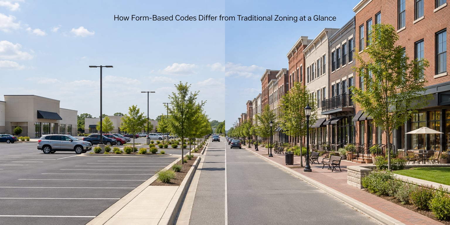
Eight differences carry most of the weight. If a proposed code changes these, it is a form-based code, whatever the local politicians call it.
- The organising principle. Traditional zoning sorts land by use. A form-based code sorts land by the physical outcome you want.
- The map. A zoning map shows districts. A regulating plan shows frontage types and building type districts on each street.
- Building placement. Conventional codes push buildings back from the street. Form-based codes usually push them toward it.
- Density control. Floor area ratio is a blunt ceiling. Form-based codes use height ranges, frontage, lot coverage and building type together.
- Parking. Minimums are common in both. Form-based codes add rules about where spaces may sit, usually behind or beside the building.
- Use regulation. Form-based codes do not abandon use controls. Real examples are hybrids that keep them for genuinely incompatible activity.
- Review process. Conventional review checks compliance with dimensional standards. Form-based review adds a design conversation about the public space.
- Outcome. Traditional zoning permits a wide range of outcomes. Form-based codes aim for a narrower, more predictable one.
| Regulatory dimension | Traditional (Euclidean) zoning | Form-based code |
|---|---|---|
| Organising principle | Separate incompatible uses | Produce a specific physical pattern |
| Primary map | Zoning map coloured by district | Zoning map plus a regulating plan |
| Building placement | Setback minimums measured from the lot line | Build-to zone or build-to line at the frontage |
| Frontage | Usually unregulated | Named types: shopfront, stoop, porch, forecourt, arcade, dooryard |
| Height | Often a flat maximum or story count | Height range per frontage type, with step-backs |
| Density | Floor area ratio cap | Height, coverage, frontage and building type working together |
| Parking | Minimum stalls per unit or per square foot | Counts plus location rules, shared and reduced minimums |
| Use regulation | The central function of the code | Retained, usually through a hybrid overlay of use tables |
| Public space | Left to subdivision layout and engineering standards | Regulated through street sections, public rights-of-way and frontage zones |
| Review | Dimensional compliance, then variance if it fails | Compliance plus design review of the street wall |
| Escape hatch | Planned unit development with its own rules | Fewer gaps, because the pattern is spelled out |
| Typical result | A wide range of outcomes within one district | A narrower, more consistent street |
One row deserves emphasis. Use regulation is not where form-based codes end, even though early explanations sometimes made it sound that way.
What Is Traditional Zoning?
Traditional zoning is land use law. It divides a municipality into districts, assigns a use list to each district, and sets intensity rules for anything built there. The Form-Based Codes Institute and the American Planning Association both trace this model to the 1916 New York City Zoning Resolution, which made separation of uses an explicit legal objective.
The logic underneath it is straightforward. A factory next to a house creates noise and smoke, so separate them. A shop next to a warehouse creates truck traffic, so separate them. Put every residence in one district, every shop in another, and the conflicts fall on district boundaries instead of on neighbours.
That logic built most of North America. After the Second World War it was reinforced by highway construction, mortgage rules and federal lending standards, and the result was the low-density, car-dependent pattern we now argue about.
The standard controls in a conventional district
Conventional districts are regulated with a fixed set of numbers:
- Permitted and conditional uses for the district
- Minimum lot size and minimum setbacks on every property line
- Maximum building height and maximum floor area ratio
- Maximum lot coverage
- Parking minimums expressed as stalls per dwelling unit or per thousand square feet
- Sign, yard and screening standards
You can comply with every one of those and still produce an unpleasant street. A six-foot setback, a surface parking lot, and a blank wall of any length are all fully legal inside a commercial district on a main road.
The three types of zoning people usually mean
When someone asks about “the three types of zoning,” they are usually pointing at residential, commercial and industrial districts — use categories, not design approaches. Other groupings exist. Some planners split residential density into single-family, multi-family and mixed-use. Others separate industrial from everything else and add agricultural, institutional and open space. None of these groupings changes what the district is organised around.
The planned unit development escape hatch
Conventional codes have a known loophole. A planned unit development, or PUD, is approved as a separate mini-code with its own street layout, density and sometimes use mix, even when it sits in a single-family district. Councils often approve them because the project promises amenities and the applicant argues the housing is needed.
The result is that a jurisdiction can show low-density zoning on the map while quietly producing suburban density on the ground. Form-based codes are, among other things, an attempt to close that gap by writing the pattern into the ordinance itself.
What Is a Form-Based Code?
A form-based code regulates the physical form of buildings rather than primarily separating land by use. It organises development by place type, assigns each frontage a desired relationship between building and street, and converts that intent into measurable rules for height, frontage occupation, ground floor treatment and parking location.
The Form-Based Codes Institute, the standards body most codes cite, frames the field this way: a form-based code is a land use regulation tool that fosters a more walkable, compact and mixed-use environment. The emphasis is on the code producing a specific physical result, not on what a parcel is allowed to do.
What a form-based code actually addresses
Municipal descriptions tend to list a similar set of elements, and this list is worth keeping in mind when you read a draft ordinance:
- Streets and street sections, including width, curb, tree zone and sidewalk
- Blocks and how they are laid out
- Lots and their relationship to the street
- Building type, features and location
- The area between the building and the street, known as the frontage zone
- Signs and the public-private interface
- Landscaping and open space
- Land use, through tables carried over from conventional practice
Notice the last item. A well-drafted form-based code still tells you whether a corner storefront can sell alcohol or whether a machine shop belongs two blocks away.
The regulating plan is the real map
The most visible tool is the regulating plan. Instead of colouring whole parcels one colour, it draws the frontage of every street and assigns each stretch a frontage type and a building type district. Reading the regulating plan tells you, before any application is filed, that this block will be four to six storeys with shopfronts, while the next block is three storeys with stoops.
Transect and place-type frameworks
Most form-based codes organise space into a sequence that runs from more urban to less urban, and that sequence has a name: a transect. The New Urbanism movement popularised the idea of six transect zones from rural edge to urban core. A place-type framework does similar work with named places such as main street, mixed-use core, or neighbourhood centre. The naming differs by city; the function does not.
A real ordinance in miniature
Clearfield, Utah’s downtown plan illustrates how concrete this gets. The city described its downtown as a set of places: a Civic Center with a tall civic frontage and the tallest buildings in the plan, a mixed-use residential area called Mabey Place, an Access Point around the station area, and the connecting commercial corridor with urban commerce frontage. Each district carried its own height range and use rules.
Lafayette, Colorado took a similar approach in a process where even experienced members of the working group said they were unsure what “form-based code” meant. That reaction is common, and it is a good sign of a live discussion rather than a dead one.
How Form-Based Codes Differ from Traditional Zoning in Their Core Rules
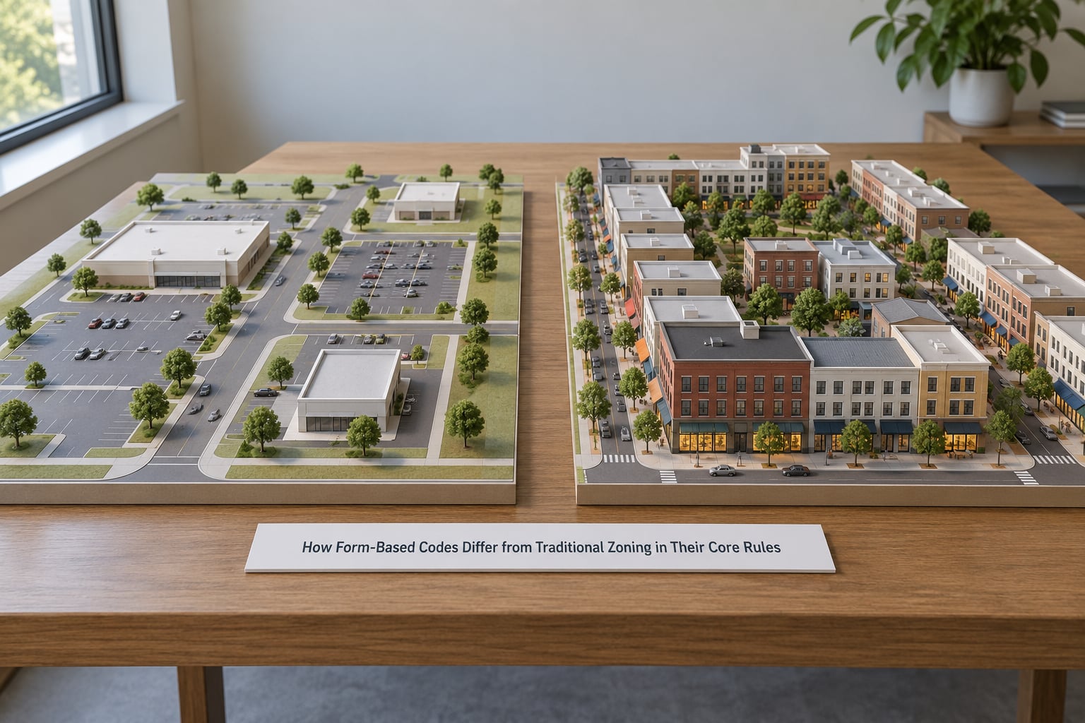
Both systems control height and land use. The difference is in what the rules are trying to produce, and therefore in which controls the code reaches for first.
Different assumptions about adjacency
Conventional zoning treats adjacency as a problem to be prevented: two incompatible uses should not touch. Form-based codes treat adjacency as a design question: these two uses can be compatible in a particular arrangement, with the right frontage, entrance and separation. That single shift changes how a corner parcel gets designed.
Setbacks versus build-to zones
This is the clearest mechanical difference. A conventional commercial district might require a five-metre front setback and nothing about what happens in it, so the building can sit at the back of the lot with parking in front. A form-based frontage type might set a build-to line and require the building to occupy at least sixty percent of the frontage within it, leaving a frontage zone of a specified depth for stoop, porch or forecourt.
The build-to zone is not just a smaller setback. It controls where the front door is, how the ground floor meets the sidewalk, and how many separate entrances a block has.
Frontage types as a design vocabulary
A frontage type is a repeatable rule set describing one way a building can meet a street. Common types include the shopfront, with large ground floor glazing and frequent entrances; the stoop or dooryard, with a raised entrance and a planted strip; the porch, typically lower-scale residential; the forecourt, where the building sits back with parking or planting in front; and the arcade or colonnade, where the ground floor is set back behind a covered walkway.
Each type carries its own height range, ground floor height, transparency requirement and blank wall limit. A corner can combine two types on two streets, which is how codes handle the awkward parcels that used to become parking lots.
Density expressed as a range, not a ceiling
Floor area ratio is a maximum. It tells you nothing about what you may build, only how much. Form-based codes replace the single ceiling with a range: three to five storeys on a residential frontage, six to eight along a commercial corridor, with the option of one additional storey if the developer builds the wider sidewalk the code wants.
Parking location as a form control
Minimums matter, but many form-based codes changed location more than count. Parking is required to sit behind or beside the building, screened from the street, or in a shared lot on the edge of a block. Structured parking is treated as a building element with frontage, transparency and step-back rules, because a garage wall is still a wall that faces the street.
That is also where the cost argument lives. Required ground floor heights, articulated facades and structured parking all raise construction cost per square foot, and codes have to decide whether that cost lands in rents.
What actually stays regulated
Use. Practitioners consistently report that adopted codes are hybrids: form standards do the work of shaping the street, and a separate use framework keeps handling genuinely incompatible activity such as heavy industry, hazardous materials or late-night bars next to homes.
Traditional Zoning vs. Form-Based Codes: Use, Density, and Design
The same corridor produces very different results under the two systems. Here is a worked example, with the numbers invented for illustration rather than lifted from any real ordinance.
The corridor
Take a four-block commercial street with a bus route, small shops currently living in converted houses, and surface parking behind them. The municipality wants housing upstairs, retail at the ground floor, and a continuous pedestrian edge.
What a conventional code permits
Under a typical commercial district, a developer could build a four-storey mixed-use building covering sixty percent of the lot, set five metres back from the street, with surface parking in front, no transparency requirement on the ground floor, and a sign area governed only by district signage rules. The building is legal. It leaves a gap between the sidewalk and the shops, and the street edge reads as a parking lot with a building behind it.
A second developer on the next parcel could do the same thing, or could build a one-storey building with a much larger front setback and a blank wall. Both are fully compliant, and the street can end up continuous, broken, or blank, with nothing in the ordinance distinguishing them.
What a form-based code permits
Under a form-based corridor frontage, the same corridor is assigned a shopfront type with a build-to line, a requirement that the building occupy at least sixty percent of the frontage, a four to six storey height range, a minimum ground floor height of about four metres, a transparency threshold on the ground floor, a limit on the length of blank wall, and parking located behind or beside the building.
The compliant result is a building at the sidewalk with shopfront glazing, a step-back above the fourth storey, and the parking screened at the rear. A second compliant building on the next parcel has different shopfront details but the same frontage discipline. The street edge is continuous by rule rather than by luck.
Neither result is automatically good. The form-based version costs more to build and constrains the designer’s freedom. That is the trade being made: less variety in exchange for a specific public outcome.
Where hybrid codes sit between the two
Many cities adopt a Unified Development Ordinance instead of a pure form-based code. A UDO keeps conventional use districts and floor area ratio while borrowing form-based tools such as frontage types, build-to lines and a regulating plan overlay. Cities with strong existing commercial corridors often take this route, because it avoids re-mapping the whole jurisdiction at once.
Which Approach Is More Flexible?
Neither system is flexible in the abstract. Flexibility is a property of a specific code written by a specific city, and the honest answer is that the question has to be split in two.
For an applicant, a form-based code is often more predictable. In Lafayette, Colorado, developers and staff described the draft as more plug and play, because the details of a compliant project are already spelled out. You know what you can and cannot do before you spend money on drawings. A conventional code can be equally certain, but it permits a wider range of results, so two applicants can read the same district differently.
For the outcome, a form-based code is deliberately less flexible. That is the point. It narrows the range of permitted outcomes in order to produce a specific kind of street, and it may also prescribe frontage, materials and design details that a conventional code would leave alone.
The trade-off that gets argued about
The criticism most often aimed at form-based codes is that prescriptive standards shrink the public conversation. If a project complies, is a design review still meaningful? Resident advocates have raised exactly this concern, and the honest answer is that it depends on how the code is written and how the city runs its hearings.
Codes written as objective, measurable standards move decisions out of a design review board and into the ordinance, where they can be inspected. Codes that rely heavily on design review move them into a public meeting, where they can be debated. A well-drafted form-based code does some of each: objective standards for the common cases, and a defined role for design review on the corners, the landmark buildings and the plazas.
Three practical limits on either approach
- The subdivision ordinance. Separate rules for lot layout and street construction can quietly defeat the intended form. If the code allows a 20-metre lot and 7-metre street but the subdivision rules produce 40-metre lots and cul-de-sacs, the frontage rules become optional in practice.
- Fire and access rules. Fire apparatus access roads and loading requirements are often set by other codes and standards. Integrated late, they can turn a short block into a surface parking court.
- Municipal capacity. Form-based review asks more of staff, because the review is about fit and relationship rather than a checklist. A city without the staffing to do it can end up with an ordinance nobody applies carefully.
The legal point, briefly
Form-based codes rest on the same statutory zoning authority as conventional codes. A city does not need special legislation from the state to adopt one, and courts have generally treated form standards as land use regulation when they apply uniformly. Style controls tied to a particular architectural look are a different matter and can draw legal challenges.
Which Should You Choose?
Match the approach to what you are trying to fix. The wrong code for the problem usually fails quietly.
Choose form-based coding when
- The street is the problem. You want buildings at the sidewalk, a mix of shops and homes, and a reason for someone to walk. This is the classic case, and downtown small area plans are the usual vehicle.
- You need predictable infill. A neighbourhood with a stable block pattern and empty lots can get faster, more consistent approvals because the rules for each frontage already exist.
- You are guiding transit-oriented development. Corridors with frequent transit need density near stops, and a height range tied to street type does that more directly than a single floor area ratio.
- You are trying to close the PUD gap. If your jurisdiction approves many planned unit developments, encoding the pattern in the ordinance removes the most-used escape hatch.
Stay conventional, or go hybrid, when
- The issue is use conflict, not form. Separating a scrapyard from homes is a use problem and a conventional buffer zone does it perfectly.
- The corridor is already built. Retrofitting form rules onto an existing strip can produce nonconforming buildings and legal exposure. Many cities apply frontage standards only to new construction or major redevelopment.
- The jurisdiction is large. A small city can draft a complete form-based code. A large one usually re-zones districts one at a time, which is what a Unified Development Ordinance is built for.
- You have heavy industrial areas. Industrial districts rarely benefit from frontage standards, and forcing them through the same template produces dead rules.
How to tell if a city’s code is genuinely form-based
Six quick checks, useful for residents and journalists as much as for planners:
- Does the code include a regulating plan with named frontage types?
- Are there build-to lines or build-to zones rather than only minimum setbacks?
- Does each frontage type carry its own height range?
- Are parking location rules written into the code, not just engineering standards?
- Does the code address ground floor height and transparency?
- Were the illustrations and the text checked against each other before adoption?
That last one catches more problems than people expect. Draft codes often ship with diagrams that contradict the written standards, and those diagrams carry the vision while the text carries the enforcement.
Frequently Asked Questions
Are form-based codes and traditional zoning opposites?
They are different organising principles, not opposites, and real codes borrow from both. Traditional zoning leads with separating incompatible uses. Form-based coding leads with producing a specific physical pattern and reuses use tables where separation is genuinely needed. Almost every adopted form-based code in the United States is a hybrid that keeps conventional use controls alongside frontage, height and parking location rules.
Can a form-based code include single-use zoning?
Yes. A form-based code can be applied to an area that is intentionally single-use, such as a civic campus, a heavy industrial district or a large institutional block. The form standards still apply, so buildings still have to meet the street in a defined way, but the use list stays narrow. The point of form-based coding is the relationship between building and street, not the mixing of uses.
Does form-based zoning automatically allow denser development?
No. Form-based codes often reduce the maximum height while raising the floor area ratio, because buildings that sit at the sidewalk and cover more of a lot use less land for the same square footage. Some cities get more density; others reallocate it to create housing above retail. What changes reliably is the pattern of density across a street, not the total amount.
What is the main difference between Euclidean zoning and form-based zoning?
The main difference is the organising principle. Euclidean zoning sorts land by use and controls intensity with setbacks, lot coverage and a floor area ratio. Form-based zoning sorts land by intended physical outcome and controls it with frontage types, build-to lines, height ranges, ground floor rules and parking location. Use regulation survives in both; it simply stops being the primary driver.
How do form-based codes affect developers and architects?
Design decisions get made earlier and more publicly, because the code shows the expected street before a site is purchased. Developers and architects in Lafayette described a draft form-based code as more plug and play, since compliant details are spelled out in advance. The cost is less freedom in frontage, materials and massing, and more attention to the subdivision ordinance and other rules the code does not control.
Is a form-based code required for a walkable neighborhood?
No, though it helps. A walkable street depends on sidewalk quality, crossings, traffic speed, tree canopy, transit service and safe crossings as much as on zoning. Form-based coding supplies the block and frontage structure that makes those improvements usable, and it removes the parking-lot frontage that conventional minimums often produce. Cities that adopted form rules without changing street design have still seen modest results.
Conclusion
Here is how form-based codes differ from traditional zoning, in one line: traditional zoning separates uses, and a form-based code shapes a street. Everything else — build-to lines, frontage types, parking behind the building, height ranges instead of a single cap — follows from that choice of organising principle.
Before you support, propose or evaluate either system, do three things. First, write down the physical outcome you actually want on a specific block, because a code cannot be evaluated against an intention nobody has stated. Second, open the current ordinance and count how many compliant projects it would permit with a parking lot in front of the building. That number is your baseline. Third, read the subdivision ordinance, the street standards and the parking rules next to the zoning code, because the form you adopt can be quietly undone by three other documents.
If the goal is a walkable main street or a denser corridor around transit, a form-based code or a hybrid Unified Development Ordinance is a defensible tool. If the goal is separating genuinely incompatible activity, conventional zoning already does that job. Cities like Clearfield, Lafayette and Rogers chose form rules for downtown districts specifically; Raleigh folded similar tools into a broader ordinance. Both routes are real, and the difference between them is not ideology so much as whether the code was written to produce a street or to classify land.