A curb management program is a city system for deciding who gets to use a few feet of street edge, for how long, at what cost, and what happens when someone breaks the rule. That is the short answer to how curb management programs work: cities map the curb, write rules for each segment, price or permit the busiest pieces, enforce those rules, then measure what actually happened and reallocate space.
The smart city problem underneath it is simple. A block of commercial street might have 150 feet of usable curb. A restaurant needs unload space at noon, a delivery van needs ten minutes at 7 a.m., a bus needs to stop for twenty seconds, a rideshare driver needs a legal spot for two minutes, and someone with a disability needs an accessible loading space every day. Without a system, all of those people circle the block looking for the same few feet.
Here is what usually gets decided, in plain terms:
- The curb is measured and mapped segment by segment, not treated as one continuous strip.
- Each segment is typed — loading, passenger pick-up, short-term parking, transit, micromobility, accessible, flex.
- Rules travel with the type: hours, duration limits, vehicle types, who is exempt.
- Some segments are priced or permitted so demand shows up in data instead of in double-parking.
- Enforcement and communication repeat the same message everywhere a driver might look for it.
- Utilization numbers drive the next round of changes, usually once or twice a year.
Table of Contents
- What Is a Curb Management Program?
- How Curb Management Programs Work
- Step 1: Inventory every curb segment
- Step 2: Type the segments into curb zones
- Step 3: Write rules and hours for each zone type
- Step 4: Decide whether the zone is free, metered, or permitted
- Step 5: Publish the rules everywhere drivers look
- Step 6: Enforce and collect payment
- Step 7: Measure, then reallocate
- How Cities Inventory and Classify Curb Space
- How Cities Set Curb Rules and Prices
- How Curb Use Is Assigned and Coordinated
- How Digital Curb Management Systems Support Operations
- How Cities Monitor Performance and Make Adjustments
- How Enforcement and Public Communication Work
- Examples of Curb Management in Practice
- Frequently Asked Questions
- What is the main goal of a curb management program?
- How is curb space usually divided among different users?
- Does curb management always mean charging for parking?
- Who manages the curb in a typical city?
- How do cities use data to change curb rules?
- What should a city do before launching a curb management pilot?
- Conclusion
What Is a Curb Management Program?
A curb management program is a city-led, data-driven system that divides street edge into defined zones, assigns each zone a use, a time limit, and a price or permit, then enforces and measures those rules over time. It is not a parking program with a different name. Parking is one use among many, and it is usually the least important one at the busiest hours.
The program exists because curb space is a finite public asset that gets consumed by private activity, and the old way of managing it — a painted loading zone here, a two-hour limit there, enforced by whoever shows up — produces double-parking, blocked bike lanes and crosswalks, blocked bus stops, and lost delivery productivity. Cities running a real program treat allocation as an operations problem with a feedback loop, not as a sign-painting project.
Keep it separate from two neighboring things. Transportation planning sets street geometry and network policy; curb management runs the day-to-day allocation of the edge. Parking management is a subset. A city can convert a parking lane to a bus lane and still needs a curb program for everything left over.
How Curb Management Programs Work
Every program runs the same loop, whether it is a two-block pilot or a citywide rollout. The loop repeats because curb demand moves with construction, new businesses, event seasons, and changes in delivery volume.
Step 1: Inventory every curb segment
Planners start by walking or driving the network and logging each curb segment: its length, physical constraints, current signage, meters, paint, and whatever restriction already applies on paper. Nothing else works until this baseline exists, because most cities discover during the inventory that their records and their streets disagree.
Step 2: Type the segments into curb zones
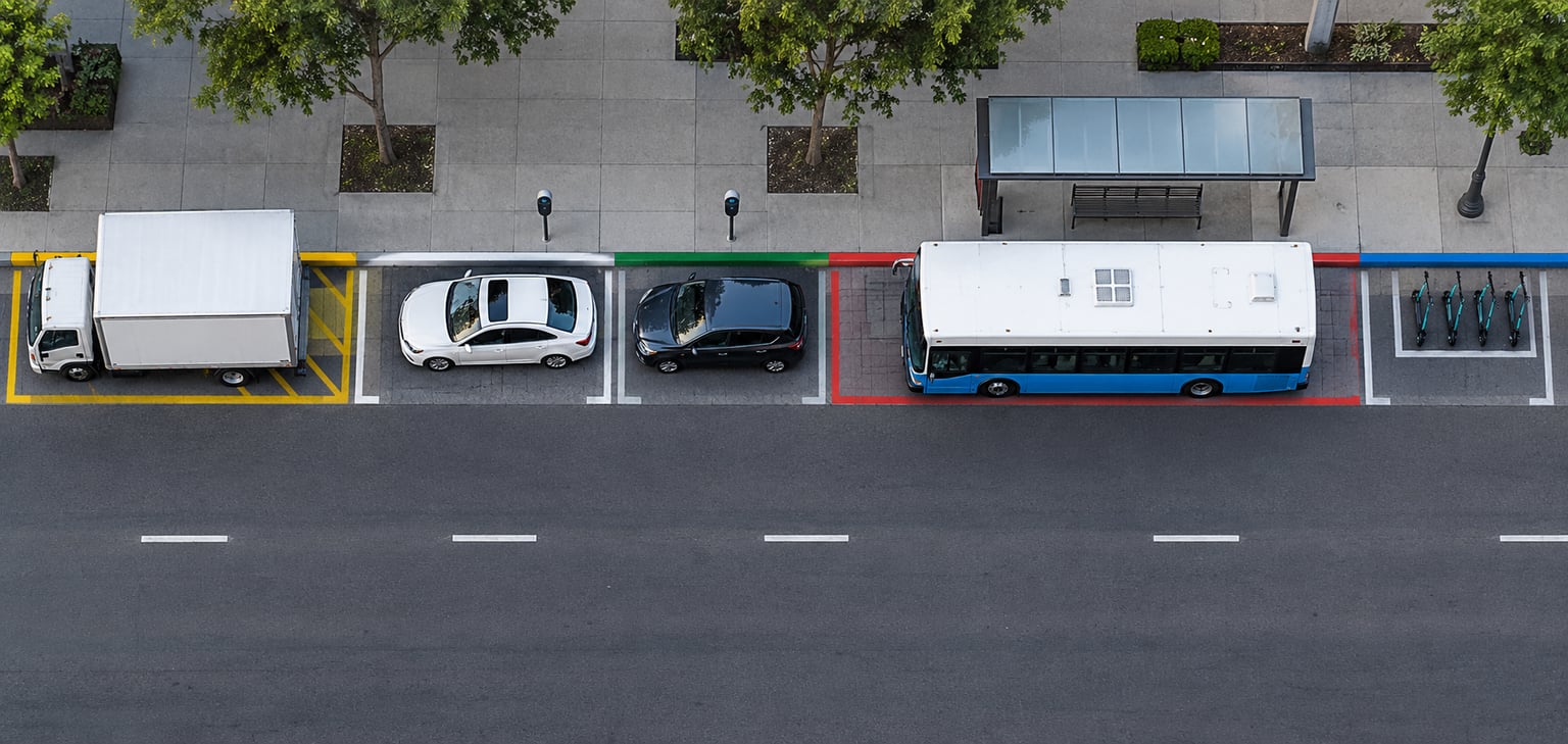
Segments are grouped by function — commercial loading, passenger pick-up and drop-off, short-term customer parking, transit stop, micromobility corral, accessible loading, flexible or convertible use, and daylighting at intersections. Typing is what makes a rule enforceable and what makes utilization data comparable later.
Step 3: Write rules and hours for each zone type
Each type gets a standard policy: how long a vehicle may stay, which vehicles qualify, which hours it operates, and how the rule changes on cleaning days or event days. Standard rules applied uniformly are easier for drivers to learn and cheaper to enforce than block-by-block improvisation.
Step 4: Decide whether the zone is free, metered, or permitted
Cities pick a pricing and access model per zone based on demand and policy goals. Free open-access zones stay on low-demand streets; high-demand zones get meters, per-minute loading rates, or digital permits that make the curb a scarce resource on purpose.
Step 5: Publish the rules everywhere drivers look
A rule only works if a driver can find it. That means physical signs and paint, a parking authority website, a map and app, and a data feed that fleet and delivery platforms can query so their routing software sees the same restriction the sign shows.
Step 6: Enforce and collect payment
Citations, meter payments, permit records, and camera-based enforcement feed the same database that holds the rules. Enforcement intensity is usually tuned by zone: heavy where turnover drives revenue and safety, light and warning-first where a mistake is more likely to come from confusion.
Step 7: Measure, then reallocate
Occupancy, dwell time, violations, and access complaints get reviewed on a fixed cycle, usually quarterly or annually. Zones that run full all day get resized or repriced; zones that sit empty get relaxed or converted. That adjustment step is what separates a curb management program from a one-time re-striping project.
How Cities Inventory and Classify Curb Space
The inventory phase decides how much precision a program can ever have. Cities combine four sources, and most need all four because each one goes stale at a different speed.
- Field surveys and video. Crews record segment length, driveways, hydrants, bus stops, tree wells, and sight-line limits. This is the slowest but most reliable source.
- Street assets. Signs, curb paint, meters, and pay stations are already georeferenced. Cities that tie policy to those asset records — the approach some call a belts-and-suspenders model — get automated updates when a sign is replaced.
- Payment and permit records. Meter transactions, permit applications, and citation data show which segments people actually use.
- Sensor and camera feeds. Automated license plate readers, probe data, and curb detection from parked-vehicle records produce occupancy counts over weeks rather than snapshots.
Physical constraints get recorded at the same time, because they decide what a zone can be. A fire hydrant or a driveway throat caps how long a loading segment can run. Intersection daylighting removes the first stretch of curb near a corner from any parking use at all. A blockface that cannot fit a 20-foot no-parking approach near an intersection is a hard limit, not a preference.
| Curb zone type | Typical rules | Who uses it | How it is usually charged |
|---|---|---|---|
| Commercial loading | Time-limited, commercial vehicles only, active hours | Delivery, courier, service vehicles | Permit, free window, or per-minute rate |
| Passenger pick-up and drop-off | Short duration, no parking away from vehicle | Rideshare, taxi, personal pick-up | Free or metered by the minute |
| Short-term customer parking | One to three hours, posted limits | Shoppers, diners, visitors | Metered |
| Transit stop | No-stopping near the stop face | Buses and shuttles | Not charged |
| Micromobility corral | Devices only, corralled to a marked area | Scooter and bike-share operators | Operator permit or fee |
| Accessible loading | Unrestricted duration with valid permit | People with disabilities | Free, permit-verified |
| Flex or convertible | Parking by default, convertible on posted days | Dining, events, delivery | Varies by posted use |
| Daylighting | No stopping near intersection | Safety, visibility | Not charged |
How Cities Set Curb Rules and Prices
Rule-setting starts with street type and demand, not with a citywide template. A downtown retail block with heavy restaurant turnover needs shorter loading windows and a dedicated pick-up zone than a neighborhood commercial street with low turnover. Transit corridors need the curb kept clear near stop faces. School blocks need daylighting and timed restrictions around arrival and dismissal.
Three rule levers do most of the work: time limit, vehicle eligibility, and hours of operation. Shrinking operable hours is often the cheapest fix for a loading zone that is oversupplied at midday and jammed at 7 a.m. Relocating a zone to the middle of the block, or shortening it, does more than adding enforcement.
Pricing is a separate decision, and it is the one residents react to most. The models in common use:
| Model | How it works | Fits best when | Watch out for |
|---|---|---|---|
| Free, open access | No charge, time limit enforced by citation | Low-demand side streets, pilot zones | Idle vehicles and no demand data |
| Flat hourly rate | Standard meter rate for the zone type | Steady demand, easy to communicate | Peak and off-peak treated the same |
| Demand-responsive | Rate or allocation shifts with measured occupancy | Cores with heavy all-day demand | Harder to explain, harder to trust |
| Permit-based | Only permit holders may use the segment | Dedicated commercial loading, freight | Excludes small businesses without fleet volume |
| Reservation or booking | A driver or fleet claims a specific space and window | High-value, high-turnover curbs | Requires enforcement of the reservation itself |
Residents often read any conversion of free curb to priced curb as a revenue move, and that objection is fair to take seriously. The defensible version of the argument is capacity: a curb that no one can hold during a two-hour window serves one business instead of four, and pricing or permitting is one way to make the turnover visible.
How Curb Use Is Assigned and Coordinated
Once zones are typed, the city still has to decide the assignment mechanism. Five are in common use, and they stack rather than compete.
Static rules. The painted and posted zone applies to whoever shows up, first come. It is cheap and predictable, and it works on residential and low-demand blocks.
Permits. A business, fleet, or operator holds the right to use a specific segment during specific hours. This is the standard answer for commercial loading zones where reliability matters more than raw price.
First-come-first-served with a hard limit. No allocation, but a clear duration cap and a working payment or verification path, so the space turns over on its own.
Reservations. A driver or fleet operator books a space for a window. Reservations solve the race condition that drivers otherwise resolve by circling and double-parking.
Priority rules. Some uses outrank others at certain times: transit and emergency access first, cleaning and sanitation on posted days, deliveries during business hours, short-term parking when the block is quiet.
Demand-responsive allocation. Space or price flexes with measured conditions. A smart curb, in this sense, is simply a curb whose rules or price can change in response to observed demand rather than staying fixed for the year.
Coordination is the harder half. Streets sweeping, refuse collection, utility work, film permits, farmers markets, and street festivals all need curb access too, and a program that optimizes for delivery vehicles while ignoring sanitation simply moves the conflict to 5 a.m.
How Digital Curb Management Systems Support Operations
Digital systems matter because curb rules change faster than signs can be replaced. The goal is one source of truth that the city, the parking authority, and outside platforms all read from.
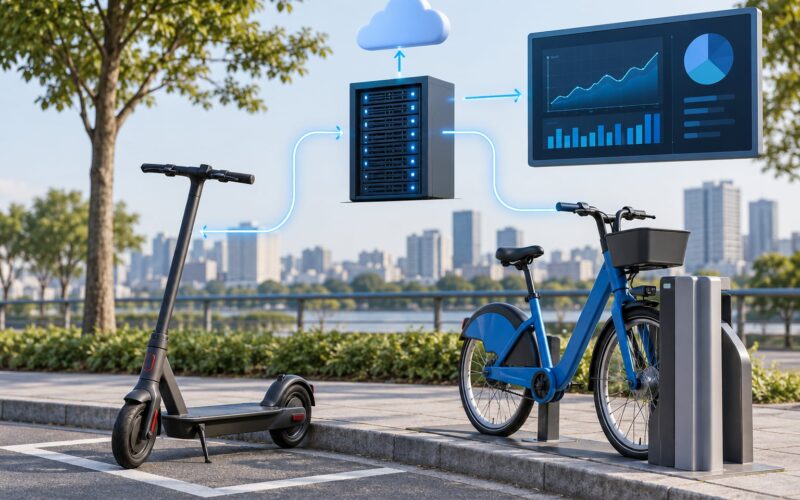
The Curb Data Specification, published by the Open Mobility Foundation, is the most widely adopted standard for this work. It describes curb space and curb zone objects in a common format so a rule written once can be displayed on a city map, enforced by a payment provider, and consumed by a delivery fleet’s routing software. It sits alongside the Mobility Data Specification, which standardizes shared trip and vehicle data.
Around that standard, cities run four kinds of tooling: a curb management platform that holds the rules and the map, a payment or permitting service, a communications layer for the public, and an API that publishes rules to fleet and delivery operators.
San Francisco’s Municipal Transportation Agency Digital Curb Project is the reference implementation most others study, because it ties policy to the agency’s own street asset records rather than to a separate survey. Seattle’s Department of Transportation has published on adopting the specification citywide, and federal funding through USDOT SMART grants has supported a number of these digitization efforts.
The procurement detail matters more than the demo. Cities that write a requirement for standard curb data into parking and mobility contracts keep the option to switch vendors; cities that buy a closed map of their own streets pay to rebuild it every time the vendor changes.
How Cities Monitor Performance and Make Adjustments
Measurement is what separates a managed curb from a signed curb. The metrics below are the ones cities actually track on a reporting cycle.
| Metric | What it measures | Why it drives decisions |
|---|---|---|
| Occupancy or utilization | Share of a zone’s hours in use | Zones near full capacity are the ones worth expanding or repricing |
| Turnover | Vehicles per space per hour | Low turnover on a delivery zone means the space is blocked, not scarce |
| Dwell time | How long vehicles actually stay | Shows whether posted limits match real behavior |
| Double-parking rate | Vehicles stopped outside designated space | The clearest safety and blockage signal |
| Bike lane and crosswalk blockage | Obstruction events at a segment | Directly ties curb rules to street safety goals |
| Freight or delivery access | Deliveries completed inside the zone, at the right hour | Shows whether business needs are actually being met |
| Violations and citations | Enforcement volume by zone | Shows whether rules are understood or merely present |
| Equity of access | Loading availability across neighborhoods and for small businesses | Catches displacement that citywide averages hide |
The adjustment loop is where programs diverge. A city that reviews numbers annually and reallocates a few segments each cycle gets steadily better. A city that never revisits its rules has just built a parking study with signs.
Mismatches show up in the data more often than people expect. Loading zones sized for the block’s original tenants often sit empty through the afternoon while the businesses that actually remain complain they have nowhere to unload. That is a sizing and hours problem, and no amount of enforcement fixes it.
How Enforcement and Public Communication Work
Enforcement is where a curb program is won or lost. A rule that drivers cannot find, cannot understand, or cannot pay easily generates violations that look like driver misconduct but are really communication failures.
Cities run three enforcement styles. Reactive enforcement relies on complaints and officer observation; it is cheap and uneven. Proactive enforcement uses payment records and automated license plate readers to flag violations after the fact, which raises compliance and cuts patrols but raises its own privacy and equity debates. Education-first enforcement issues warnings before citations in newly converted zones, which usually costs one season of revenue and saves a public hearing.
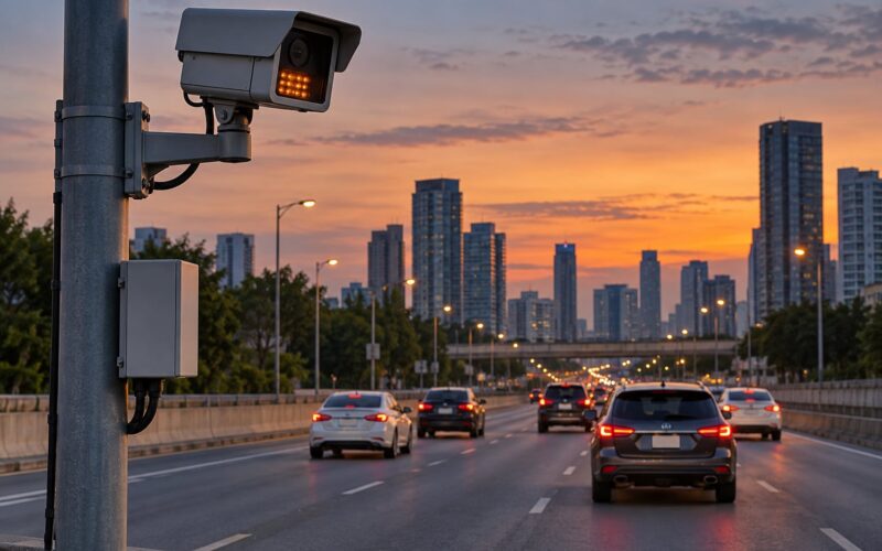
Communication usually has to happen in five places at once: the sign on the pole, the curb paint, the parking authority website, the map or app a resident uses, and the data feed a delivery platform reads. If the sign says 30 minutes and the app says 20, the driver learns to distrust both.
Appeals matter as much as citations. A driver who gets a ticket for loading in a zone that was closed for an event he could not see needs a fast way to contest it, and a small business wrongly ticketed twice in a month will tell every other merchant on the block.
Examples of Curb Management in Practice
A mixed-use block. A street with apartments above, two restaurants, and a grocer usually ends up with a loading zone in the morning hours, a pick-up zone in the evening, and short-term parking in between, with the resident side kept clear for accessible loading and deliveries. The same 150 feet of curb changes function twice a day without changing its length.
A delivery-heavy corridor. Where many small businesses share very few legal spaces, the fix is usually supply and hours rather than price: shorten the zone to match real dwell time, spread two zones across three blocks instead of stacking them, and open the loading window when trucks actually arrive. One widely cited worked example in the industry puts 30 businesses sharing 2 loading spaces, about 150 feet of curb, roughly 18 percent of a blockface — a ratio that no enforcement model can rescue.
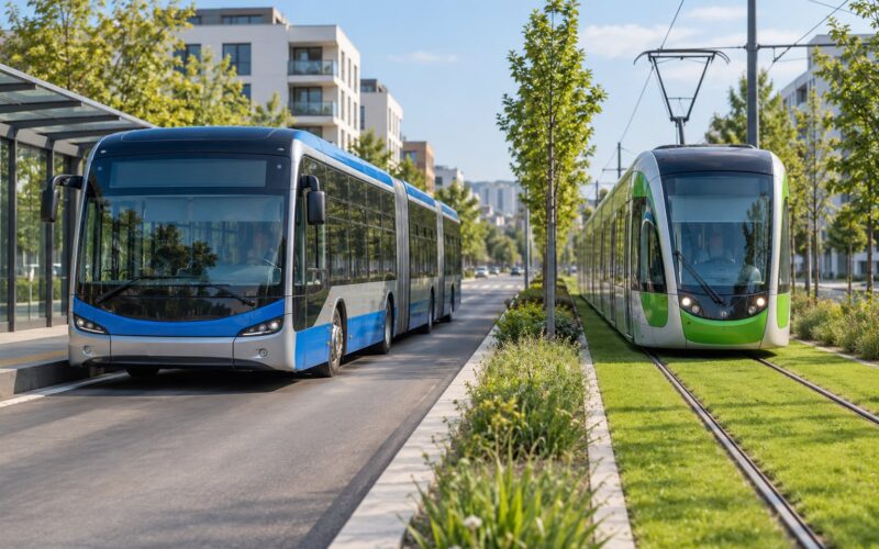
A transit corridor. Near a bus stop, the curb converts to daylighting and a no-stopping buffer, and pick-up moves to the far side of the intersection or to a mid-block zone. The goal is not parking revenue; it is keeping the bus moving and the intersection visible.
An event curb. For a street festival or a stadium event, segments flip to flex use for the day, temporary loading routes are published in advance, and enforcement shifts to keeping emergency lanes clear. Afterward the data gets archived, because event curbs are usually the one case where a city collects more demand information than it can use.
The politics are worth naming too. Several dynamic curb pilots have been paused or reversed after driver and merchant pushback, including a smart curb conversion on Manhattan’s Upper West Side. That is normal program behavior, not failure: the pilot produced data, the reaction produced a public hearing, and the next version ships with different rules.
Frequently Asked Questions
What is the main goal of a curb management program?
The goal is to allocate limited street edge to the uses that need it most, at the time they need it, without blocking bike lanes, crosswalks, or transit. A successful program turns curb rules into clear zones with posted limits, then measures occupancy and turnover so space can be moved to where demand actually is. It is an operations problem, not a revenue exercise, even when pricing is part of it.
How is curb space usually divided among different users?
Cities split the curb into typed zones, each with its own rules: commercial loading, passenger pick-up and drop-off, short-term customer parking, transit stops, micromobility corrals, accessible loading, flexible or convertible use, and daylighting near intersections. The typing depends on street type, land use, and measured demand. Some zones are free, some metered, some reserved by permit or reservation.
Does curb management always mean charging for parking?
No. Pricing is one tool among several, and plenty of successful zones stay free and open access. Cities price or meter high-demand segments so that demand appears in data instead of in double-parking, and they use permits where reliability matters more than turnover. Residential and low-demand streets usually keep free access with time limits enforced by citation.
Who manages the curb in a typical city?
Usually transportation or planning leads the program, with the parking authority or public works department handling meters, signs, and curb paint. Public works maintains the physical assets, economic development speaks for merchants, transit agencies set bus stop needs, and police or a contracted enforcement team handle violations. One department usually owns the curb data; the rest supply inputs and enforcement.
How do cities use data to change curb rules?
Cities track occupancy, turnover, dwell time, double-parking, and obstruction events per zone, then review them on a quarterly or annual cycle. Zones that stay full get resized, repriced, or extended; zones that stay empty get relaxed or converted to another use. Many cities publish rules in a standard format such as the Curb Data Specification so delivery fleets and apps read the same data as the city.
What should a city do before launching a curb management pilot?
Map the curb first and record what is actually on the street, not only what the code says. Pick two or three clearly defined pilot blocks, agree on the zone types and rules for each, set the metrics you will judge the pilot on, and publish the rules in every place a driver might look. Talk to merchants, delivery operators, and access needs before the signs go up, then commit to publishing the results either way.
Conclusion
That is how curb management programs work in practice: map the edge, type the zones, write the rules, choose the pricing and access model, publish the rules everywhere, enforce them, and reallocate based on what the data shows. The loop matters more than any single tool, because curb demand moves faster than signs do.
If you are watching or working on one, the first move is unglamorous. Map the curb, agree on zone priorities with the people who use them, pick a small pilot area with metrics you can actually measure, and publish the results whatever they say. Everything else — pricing, reservations, real-time rules — is a refinement on that decision.